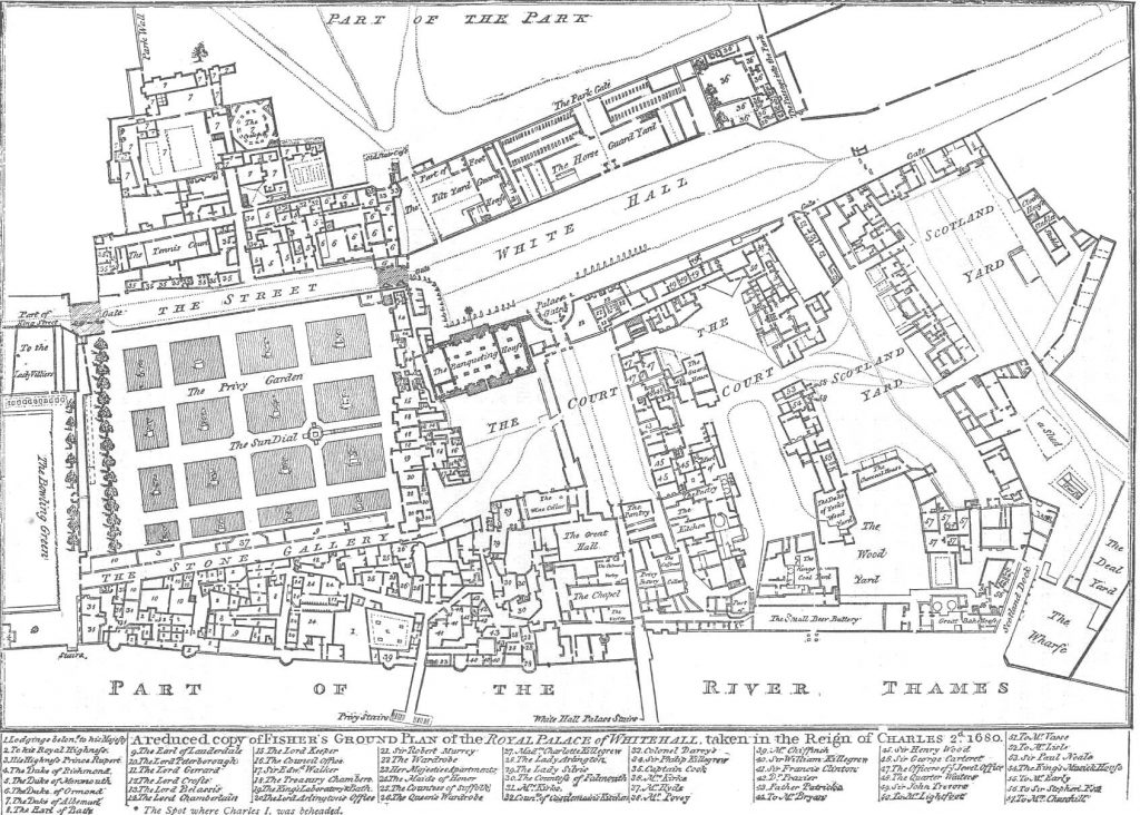
This week, my research was interrupted and slowed by having my wisdom teeth removed this Tuesday. However, in spite of that, I was able to continue my work on the REED London project. My biggest accomplishment this week was my georectification of the Whitehall map of 1680. This map presented a challenge to me previously, because it shows only a very small portion of land (the Whitehall Palace in London), and more frustratingly, a small portion of land that no longer exists on modern maps. To align Whitehall buildings with modern buildings and streets would be entirely guesswork, and so I had settled to use the Whitehall 1680 map just as a visual aid. This was until I came up with the idea of georectifying the Whitehall map to another, larger map from the same era of London. I had already georectified several maps of London that show Whitehall Palace in some detail. I was able to georectify Whitehall Palace based on other maps that were already tied to modern topography. This gives a detailed view of every Whitehall Palace building, linked to their modern location.